Mt Cook and Lake Pukaki

Mt Cook and Lake Pukaki
December 2012

Tuesday, January 1, 2013

Day 11 - Cascade Saddle

The plan was to hike to a ridge above our camp that boasted great views of the valley and mountains.  The expected time to our destination was 5 hours.  It was a classic NZ hike - no definite trail just markers every once in awhile, lots of climbing over roots and rocks and straight up.  Once we got out of the trees, it got even steeper with lots of boulders and scree.  

Awesome views of the valley below.  If you click on the picture to enlarge it, you can see some specks in the grass on the bottom left of the picture.  That is the tents.  


The other direction down the valley.

A little walk out to a beautiful view.

We saw many of these Mountain Buttercups along the way.
 Sam caught up with us and we hiked with him for awhile.  After about 4 hours of hiking, we hit some snow fields and crossed them but didn't feel comfortable without more equipment to go to the very top. It was very steep and we had already gotten the great views, so we didn't feel it was worth the risk.  Sam kept going.  We stopped for lunch at a cool spot on the way down and ran into Emmett on his way up.  We got back to camp around 4pm.  We were exhausted after a grueling hike but wanted to take advantage of the beautiful day so we made an early dinner and rested our feet for a little bit and then did  a valley hike to the Shovel Flats.  Flat sounded very good to me.
It was cool to see the same views we had just looked at from above now looking up at them.

This was the Mt Aspiring area but this is Mt Joffre.

As we were walking back to camp, we heard a noise behind us and looked back to see an avalanche on Mt Joffre.  If you zoom in you can see the snow falling from the cliff on the face of the mountain.

This was a sign at the hut that showed the names of the peaks in the area.  It was built by the family of someone that died climbing in the area.

This is the little shelter where we cooked our meals.  There was also a spigot for water.  When we got back Sam had made it back to camp. Emmett had turned around shortly after we met up with him because it was too steep.  He decided to move his camp down the valley to the area where we had just hiked.

This is a view from the shelter of our tent.  The buildings in the distance are the wardern's hut, a hut for trampers and bathrooms (with running water).  We chose to use our tent because we thought we'd sleep better. It was so quiet.  There was a river nearby and other than that, all you could hear was the wind.  I loved reading at night in the tent.  
We chatted with Sam for awhile and then headed to bed exhausted.

Sunday, December 30, 2012

Day 10 - A change of plans

We headed down the Haast Highway which had some beautiful views of the Tasman Sea and great waterfalls along the way.  We had been toying with the idea of shortening our backpacking trip we had planned from 5 days down to 2-3 to allow us to go to the Milford Sound and spend more time at Mt Cook.  We planned to stop along the way to  get more information and make our decision.
Knight Point along the Haast Highway.  Had a memorial commemorating the opening of the highway in 1965 apparently a very challenging task due to the rugged terrain.

Thunder Falls

Blue Pools - short hike to these amazingly blue pools of water.

Lake Wanaka - we stopped and ate lunch and enjoyed the view.
 We stopped at the Department of Conservation (DOC) in Wanaka to get some advice on shortening our backpacking trip and check out the weather forecasts.  After looking over our options, we decided on doing a hike in the Matukituki Valley near Mt Aspiring but when we went to buy the hut tickets for our trip, the DOC guy wouldn't sell them to us.  We were planning on leaving the next day, he said we needed to seize the good weather and just leave today.  He said we could buy the tickets when we got to the hut so it was up to us.  After thinking it over a little and making some calls to cancel our lodging that we had for the evening, we decided to go for it.  We bought some food, packed our packs and drove to the trailhead.
The hike to the hut was 4 miles along the Matukituki river and through cow and sheep pastures.  Beautiful views along the way.


There were many stream crossings to ford along the way.  I lost my balance with my heavy pack on one of them and fell into the creek which was very frustrating.  This 4 miles felt much longer and I was ready to go to sleep by the time we arrived(around 8:30pm).  Graham, the hut warden, greeted us and showed us where the tent sites were.  
Matt pitched our tent and I started dinner.  We met Sam and Emmitt.  Same was a college kid from Sydney who had hitched a ride to the trailhead with Sam who was probably in his 50s and from Hawaii.  Sam had been traveling for almost 2 months, hiking, camping and hitching around the country.  Sam came to NZ almost every year because he loves it so much.  We hung out with them for awhile until the sandflies got to be too much and we headed to our tent.  Funny to fall asleep in our tent when just 5 hours earlier we had an entirely different plan for the day.  It ended up being the right decision for sure.

Saturday, December 29, 2012

Day 9 - Another day at Franz Josef

Tip:  Double click on 1 of the pictures in a post to view all the pictures for that post in a larger format.

On our 2nd day at Franz Josef, we woke up to the view (below) outside our window and knew it was going to be a great day!  We had decided to do the Roberts Point Track.  Up until this point, it was probably the most difficult hike I had done as far as terrain.  We were clamoring over boulders(larger boulders with slippery moss), tramping through creeks and walking on narrow edges but it was also very interesting hike and rewarded us with great views at the end.
Some NZ terminology: they don't call it hiking in NZ - its tramping.  And one thing I like is they define their terms...If its called a "walk" if it is a paved or well marked trail that is relatively flat.  A "tramp"is a challenging mostly unformed track.  A "route"is unformed tracks and requires backcountry skills.  You know what you are getting into.  Another thing about tramping in NZ: they don't believe in switchbacks.  For the most part, it is straight up.

view from our window

This hike had a couple of cool swing bridges.  Another common thing found on NZ tramps.

This is the sign at the beginning.  Sadly, 3 people had died recently on the track.  If you read the fine print though you find out that the key is to not try to cross the rushing river filled with glacial sediment and debris.  check.  

This cool stair case is bolted into the side of a cliff so there is literally nothing below you.  

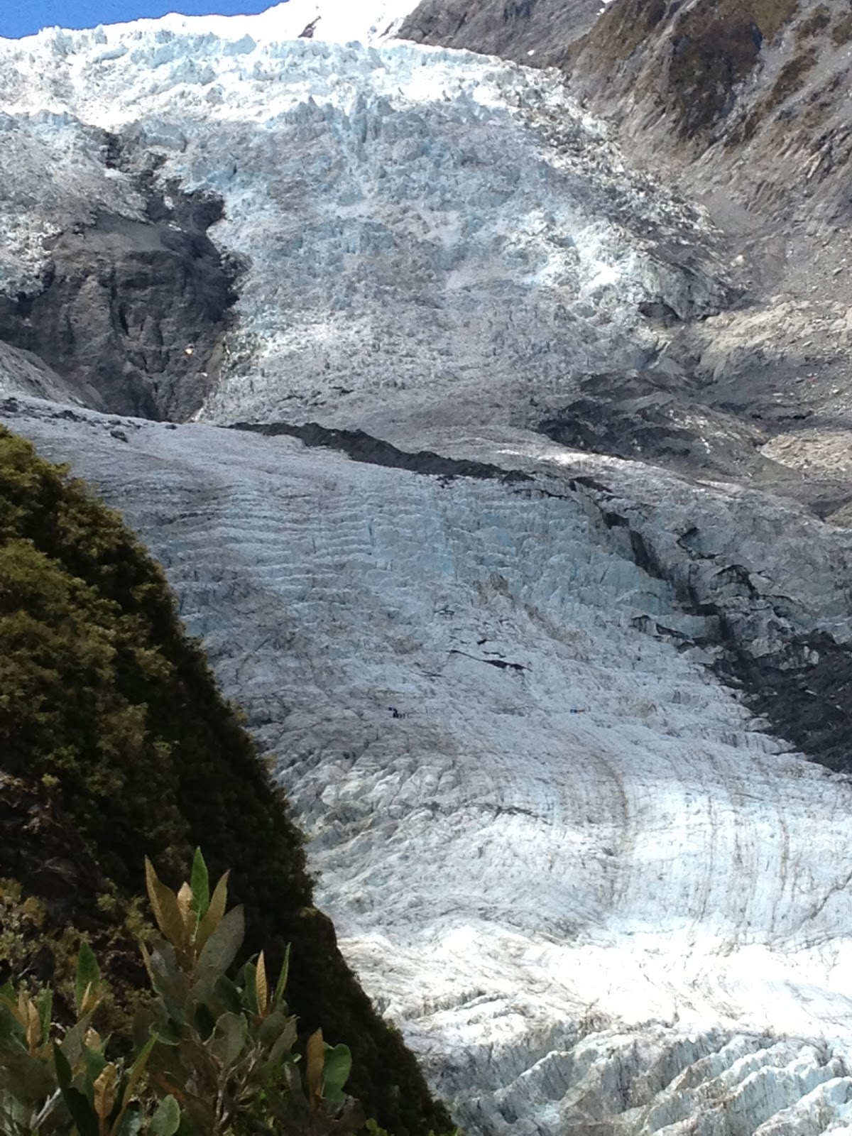
At the end of the hike there was an overlook with a great view of the glacier.  We could see helicopters dropping people off to hike on the glacier (you can only do this with a guide service otherwise it is forbidden).

The glacier extends up over the mountain.  HUGE!

This is looking down the valley toward the Tasman Sea.

Old trampers hut along the way.
The way back down was just as challenging.  We both fell a few times on the mossy boulders and lost the trail briefly.  We made it back in about 5 hours and then headed over to Fox Glacier which is about 20 miles down the road.  We did the Lake Mattheson hike which when it is clear beautifully reflects Mt Tasman and Mt Cook but this is what we saw with the low clouds:
Then we headed closer to the glacier and did the Chalet Track.  Other than 1 tricky river crossing, it was a pretty easy walk to a nice overlook with a great view of the glacier.

Fox Glacier

There was no one at the overlook so we sat and enjoyed the view for awhile before returning to our car.  We'd only seen 3 other people on this great hike.  Again, we felt we had timed things well since we had just skipped doing another hike because 3 tour buses had just pulled up to it.
After the 3rd hike, we headed back to the holiday park and packed up our things to head out the following day - thankful that daylight lasts until 10pm.

Thursday, December 27, 2012

Day 8 - Franz Josef Glacier

We got up early to do a hike called Alex Knob that Matt had done previously and had great views and saw lots of Keas (world's only alpine parrot, native to new zealand).  The clouds were a bit low that day so we weren't expecting very good views but we had some great views of the glacier, the Tasman Sea and we even  saw 1 Kea.
This was our view on one side.  You could see to the Tasman Sea.

The other side was view of the glacier.  The clouds are so low they are concealing the top of the glacier.

Our not very good picture of the Kea.  It soared right above us but we were to enthralled watching it that we didn't think to take a picture until it flew over to this cliff and sat down.  Sadly, these cool birds are endangered (see link above).

As we rose up the hike we got further into the clouds.  We couldn't see anything when we got to the top.  Oh well.  It was still a good place to stop for lunch after the challenging 4 hour hike up.

After we finished Alex Knob, we did another short hike to Lake Wombat and then did the Glacier Valley Walk.  If you click on this picture to make it bigger, you can see there are people in the bottom right to help you get an idea of how huge this glacier is.

There were tons of waterfalls coming down the hills of the valley.  By this point we had hiked 14 miles between the 3 hikes that day so I took my boots and socks off and soaked my feet for a bit in the pools of the waterfall.  It felt so good!

This cut out of a Ranger tells you this is as close to the glacier as you can go.

By the end of the day we had done about 16 miles of hiking-12 of it on very steep terrain climbing over boulders and roots and we were exhausted.  We headed back to the holiday park.  It was all we could do to make ourselves dinner and go to bed.  

Wednesday, December 26, 2012

Day 7 - Kaikoura and Arthur's Pass

Late the day before we had gotten the call that there was a spot available for Matt to swim with the dolphins the next morning at 5:30am (I did not feel compelled to jump in the ocean but watched the dolphins from the boat).  We were scheduled to leave on this day but jumped at the chance to get to go see the dolphins.
First we watched a video on how to attract the Dusky dolphins attention if you are in the water and what to do if you need help.

Once we found the dolphins the swimmers jumped off the boat and tried to get the dolphins attention.   The dolphins were very interested in the humans.  Matt had fun diving around and interacting with them.  The dolphins hung with the group for about 45 minutes.

At one point one of the other swimmers gave the distress signal.  Matt's lifeguarding instinct kicked in and he swam over to hold the guy up until the boat got to him.  Here is Matt giving the thumbs up saying he is having fun.

After the swimmers all came in the boat rode around and the dolphins played in our wake.  They were not shy about getting close to the boat and showing off.

We were so glad we had the opportunity to hang out with these cool animals in their natural habitat.

After the excitement of the dolphin swim we got in the car and drove from the East side of the island to the West side (about a 7 hour drive) over Arthurs Pass which is beautiful.   

We had to get out and take a picture.  It was a beautiful day and the mountains and lupine were like a postcard photo.  We ended our day by arriving at Franz Josef glacier, getting some groceries and checking into our holiday park.  

Tuesday, December 25, 2012

Day 6 - Kaikoura

The dolphin swim we had planned was canceled because of the weather at sea.  We were put on a waiting list for the next day but thought it unlikely since there were a number of people on the list.  We had rescheduled whale watching for this afternoon but that got canceled to so we took matters into our own hands.
This waterfall is near a seal colony and is famous because seal pups hike 300m up hill to come in play in the pool of the waterfall.  Matt is pointing at where they might be playing if they were there the day we visited:-)

There happened to be a helicopter whale watch tour next to the boat tour place so when the boat trip was canceled for a 2nd time, we walked over to see look into it.

What the heck right?  A helicopter ride was on both of our bucket lists and they had an opening a half later and a 3rd person ready to go so the cost was less.  

Kaikoura from the sky.

They time how long the sperm whales dives for and then base the tour time on when the whale should be surfacing for another breath.

The timing worked and we could see the entire length of the whale as he surfaced.

Plus the specks you see swimming around the whale are dolphins trying to play with the whale.

Whale getting ready to go back down.

His tail diving down.

There he goes.  Amazing experience.  Glad we were spontaneous and went for it.